Uttarakhand disaster, HKH
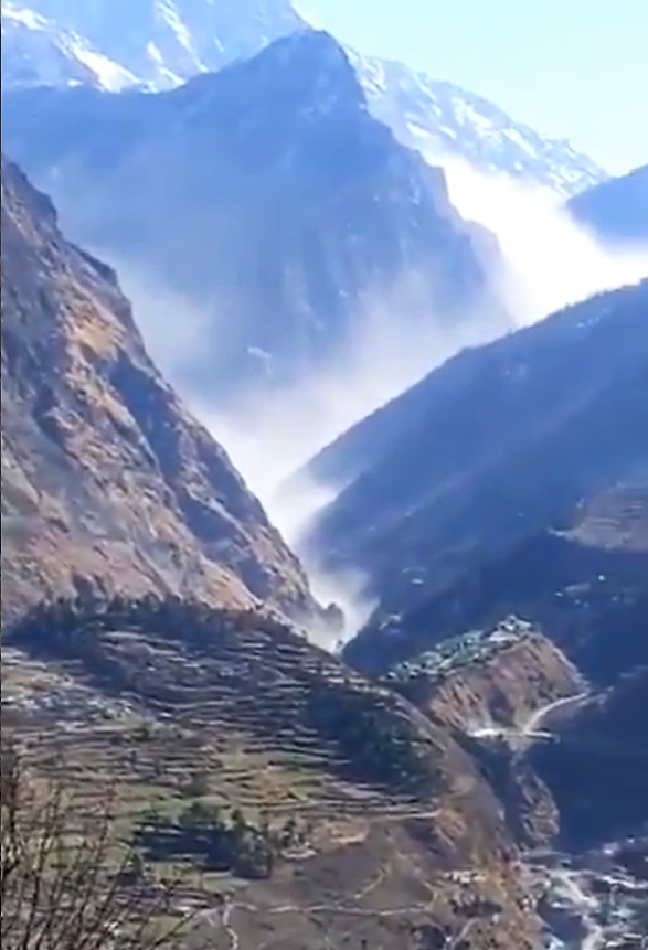
Consensus is pointing more and more towards a landslide, a combination of rock and glacier ice, as the primary cause of the devastating flash flood, that swept away bridges, roads and two dam projects in Uttarakhand, India.
Although they are not melting as fast as the Alps, the Himalayas have been warming at an alarming rate for years. A study published in Science Advances in 2019 warned that Himalayan glaciers have been melting twice as fast since the start of this century, due to climate change.
ICIMOD (International Centre for Integrated Mountain Development) mapped about 15,000 glaciers, 9000 lakes and 200 potentially dangerous glacial lakes in the HKH. Glacial retreat and permafrost thaw decrease the stability of mountain slopes, according to latest assessment reports of UN IPCC, and glacier-related landslides in the high mountain regions of Asia have grown in the last decade, according to research, increasing vulnerability of local population and raising questions about controversial large development projects in the fragile and vulnerable ecosystem of the Himalayas.
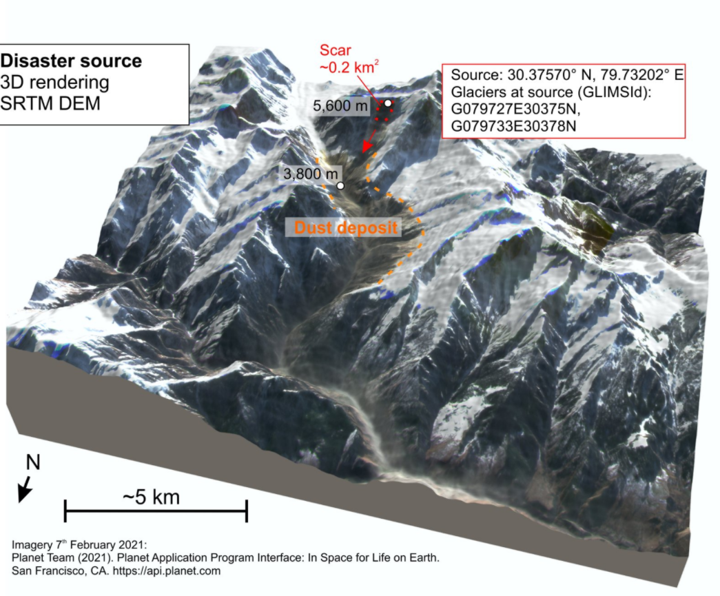
Infographic by Dr Dan Shugar
As ICIMOD Director General, Pema Gyamtsho, put it: “This is an important moment for the Hindu Kush Himalayan countries to pause and reconsider development in the mountains given the emerging risks posed by climate change”.
Mountain Wilderness International is deeply saddened by the loss of life and the many still missing and stands in solidarity with the people of HKH.