Kalam via Biasin Pass to Lake Mahodand
Trek duration: 8 – 9 days.
Group 2 started their trek in the Bahan Valley, about 30 min north of Kalam, by jeepable road.
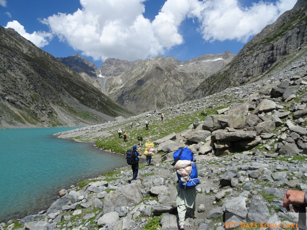
During the first three days the trekking party followed the valley uphill on shepherds’ paths, walking on the dry edge of the riverbed that runs through this impressive U-shaped valley. Vegetation changed from patches of deciduous trees and large coniferous trees to smaller birch woods and shrubs, giving finally way to treeless alpine flora and extensive scree. After passing a large lake (Lake Kooh) with its ever-changing colours the valley turned east, leading up over boulders to the last pastures, where we placed our camp at about 3700m.
On day 4 we started the ascent to the pass, turning northeast up a hanging valley, and climbing the last 400m on big and steep granite blocks towards a relatively narrow gap, marking Biasin Pass (4560 m). After crossing the partly snow-covered pass, descend to the next camp on the valley’s floor (approx. 3800m) on the same terrain was equally challenging.
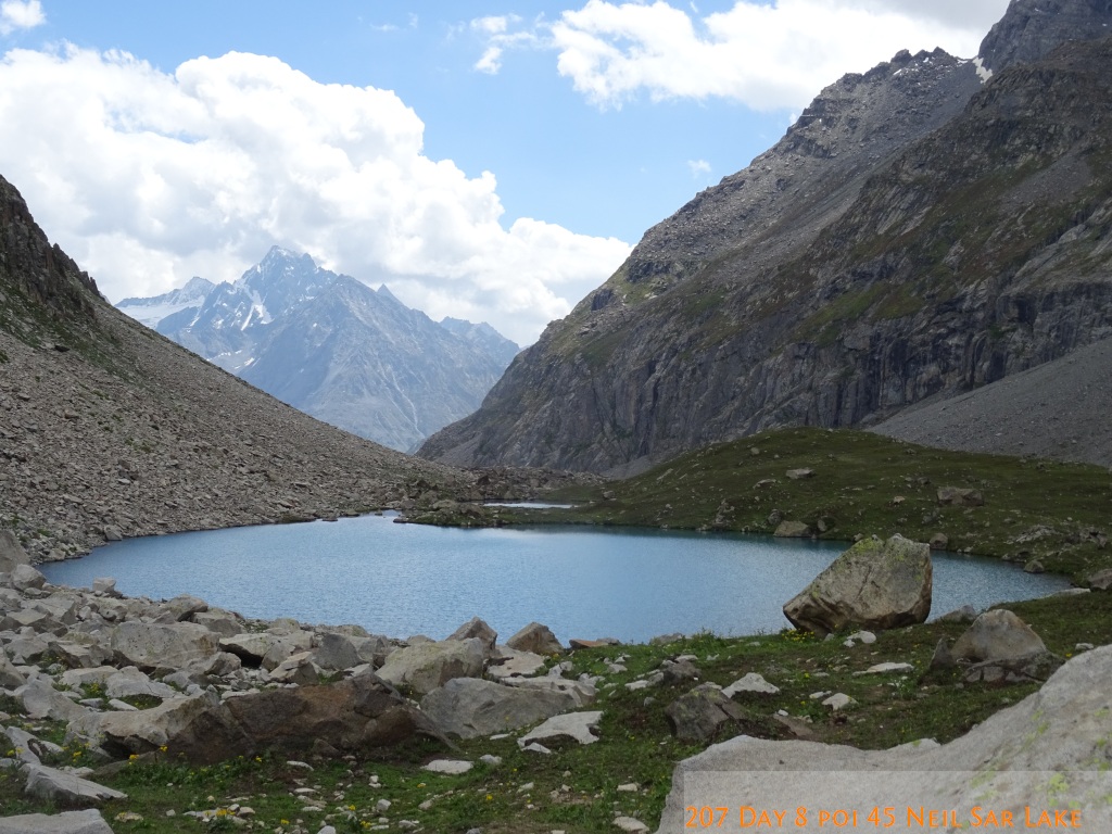
The trail led downhill through pasture land, at first scattered with goats and sheep then, passing along some huts, with horses and cows, until meeting the large, stunningly beautiful Ushur Valley (3100 m) after a final steep descend through a birch forest. Following the Ushur Valley north, upstream, passing along picturesque waterfalls and a sizeable village, the trail reached the valley end at the bottom of Kachikani Pass, Shandur Pass and Khokush Pass.
The area of this camp was on the last grassy patches scattered with Edelweiss, at the foot of large moraine walls. Returning through the Ushur Valley, the trek reached its end at Lake Mahodand (2865 m) from where the party reached Kalam by Jeep in approx. 3 hours.
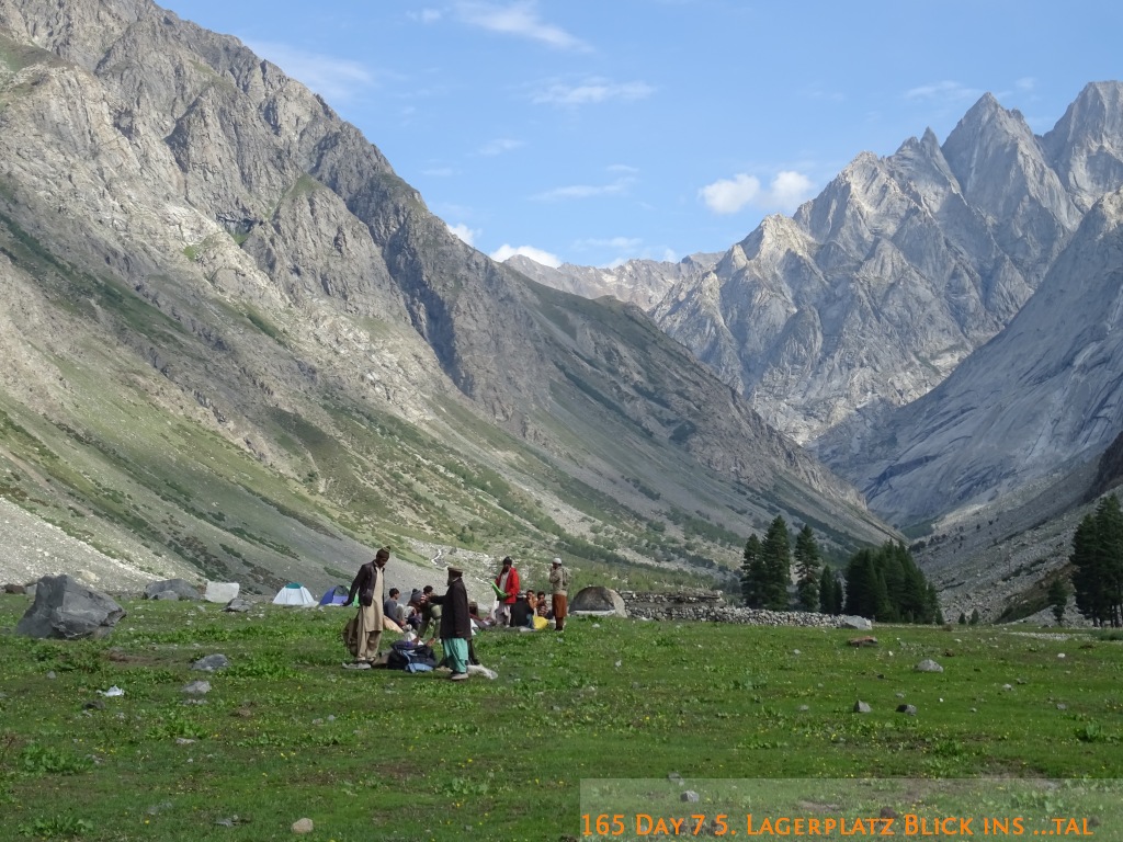
All campsites were on grassy meadows on the valley bottom, near or between meandering river branches. Summit ascents were not possible on this route. The trek is moderately difficult due to the crossing of the Biasin Pass.
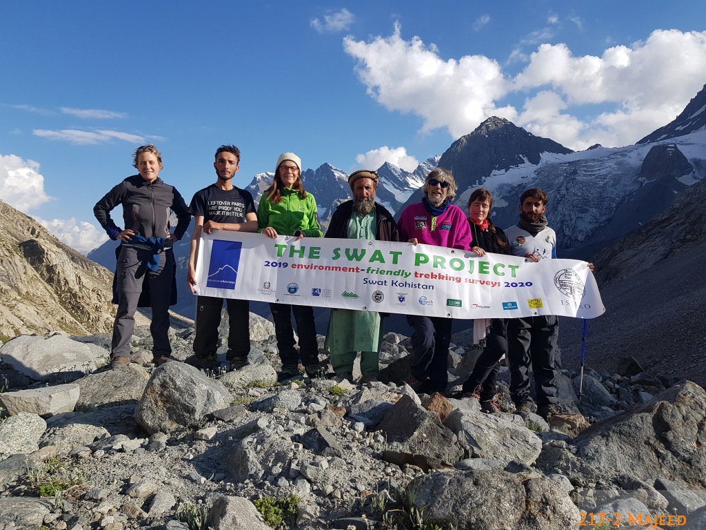
The mapping of this trail falls under The Swat Project. For further general information on the project please see previous articles on MW action in Pakistan and on the ascent to Thalo Zom.