The Shrinking Glaciers Project
As an NGO whose aim is to protect and preserve the remaining pristine wilderness areas in mountain regions and, more in general, the natural and cultural heritage of mountain areas, Mountain Wilderness International, is planning to organise exchange and networking among citizens, scientists, researchers, academia, schools, photographers, filmmakers, directors, mountain guides, mountaineers etc. in order to raise awareness about climate change and people’s ecological footprint.
We are aiming to partner up with other organisations, initiatives and bodies.
The project envisages the setting up of a platform for information and data collection and exchange, along with the organisation of actions, rallies and events either at international level or through our national chapters. We strive to reach the broadest possible public.
Glacier of the Month
In this section we will present examples of both famous and less-known glaciers that have changed over time, illustrating some of their characteristics and comparing old and recent images.
-
May/June: Medvezhiy Glacier
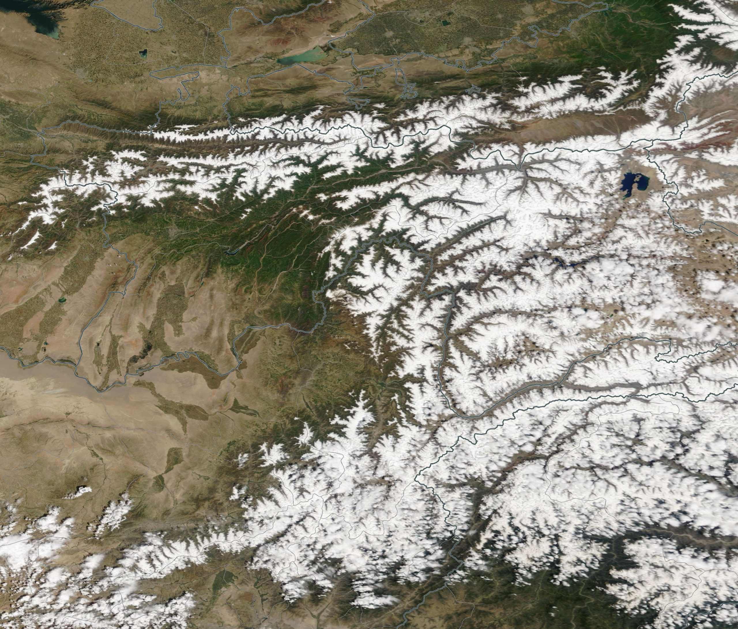
The Medvezhiy Glacier lies on the western slope of the Tajik National Academy of Sciences Range, in the heart of Tajikistan’s Pamir Mountains. Its highest point reaches 4,680 m asl, and the glacier extends for 15.8 km with an area of approximately 25.2 km².
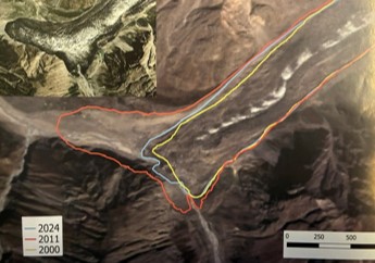
In early summer 2011, the Medvezhiy Glacier underwent a sudden and dramatic surge down its valley, surpassing the extent of its previous major surge by at least 22 years. This abrupt movement raised serious concerns among glaciologists and emergency management groups about the risk of a potential glacial lake outburst flood that could inundate the Vanch River valley.
Satellite imagery and reports from local scientists indicate that the glacier advanced between 800 and 1,000 m between June and July 2011, compared with its typical annual advance of 200-400 m. The glacier’s terminal moraine blocks the Abdukagor River and has created a lake which can reach up to 20 million cubic meters in volume during major glacial surges. It is likely that cracks and subglacial tunnels are allowing water to pass through the area. A bridge downstream was destroyed by a single water surge.
Tajikistan hosts some of Central Asia’s largest glaciers, which play a crucial role in the country’s water system. However, climate change has caused widespread glacier shrinkage. Since the 1960s, the country is estimated to have lost up to 1,000 glaciers. Under all climate scenarios, glaciers are expected to continue retreating steadily, with total ice volume potentially declining by more than 50% by the end of the century – a trend clearly reflected in hydrological models.
Glaciers in Tajikistan are unevenly distributed, with the highest concentrations in the Pamir and Tien Shan ranges, particularly in the Gorno-Badakhshan Autonomous Region (GBAO). These glaciers are vital sources of water for Tajikistan’s major rivers and for neighbouring countries. Low-altitude glaciers are melting rapidly, while high-altitude glaciers are also retreating, though at a slower pace, as temperatures continue to rise.
Courtesy + data of the Agency for Hydrometeorology of the Republic of Tajikistan
-
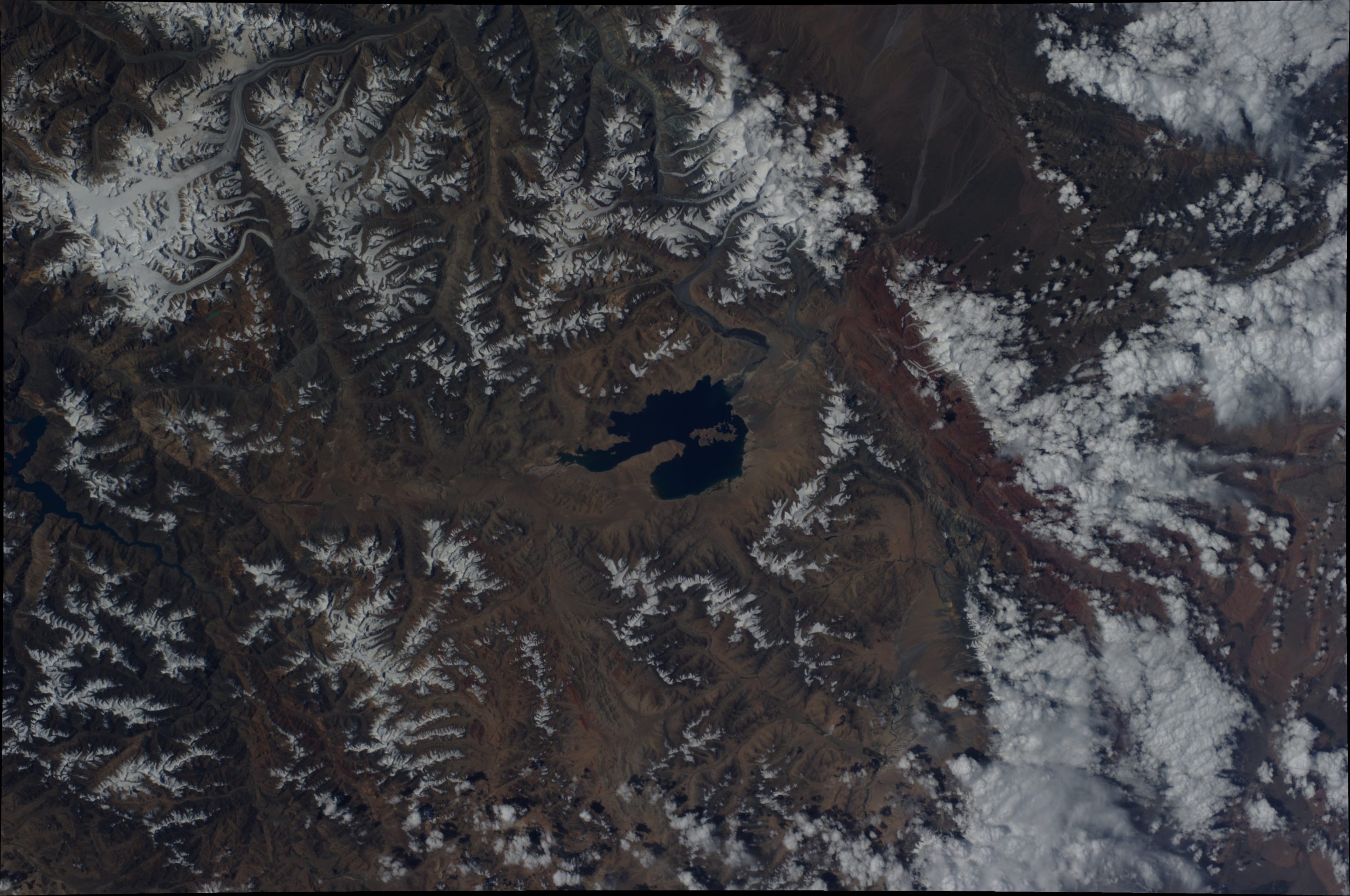
March/April: Glacial Lake Karakul, Pamir Mountains
Lake Karakul (also Kara-Kul; Tajik for “Black Lake”) is located in eastern Tajikistan, high in the glaciated Pamir Mountains, and administratively forms part of the Gorno-Badakhshan Autonomous Region in Central Asia. Covering roughly 380 km², it is a high‑altitude, endorheic glacierised-basin lake, fed by water from surrounding glaciers.
It lies south of the Trans-Alai Range, about 15 kilometres west of the border with China’s Xinjiang Uyghur Autonomous Region and approximately 225 kilometres west of the city of Kashgar in a straight line. Situated at an elevation of around 4,020 m asl, Lake Karakul is among the world’s highest large lakes. It is encircled by numerous striking, very high mountain ranges. Access from the north is possible via the Kyzyl-Art Pass (4,270 m) along the Pamir Highway. The settlement of Karaart is located on the lake’s eastern shore.
Glacial lakes are natural water bodies formed through glacial processes, particularly the melting of glacial ice and the damming of water by moraines or ice barriers. In Tajikistan, such lakes are found predominantly in the high-mountain regions of the Pamir and Hisor-Oloi systems, occurring mainly at elevations between roughly 2,500 and 5,000 m asl. Their formation is closely linked to increased melting in both the accumulation and ablation zones of glaciers.
Long-term studies of representative reference glaciers in Tajikistan show that, from the beginning of systematic glaciological surveys in 1956 until 2021, virtually all observed glaciers have been retreating continuously. This trend is particularly pronounced in the major river basins, which also contain the country’s most extensive glaciated areas. Glacier retreat is evident in the marked reduction of glacier area, the recession of glacier tongues, the lowering of glacier surfaces, and a substantial loss of ice volume.
2014 Courtesy of ISS Exped. 29_NASA* 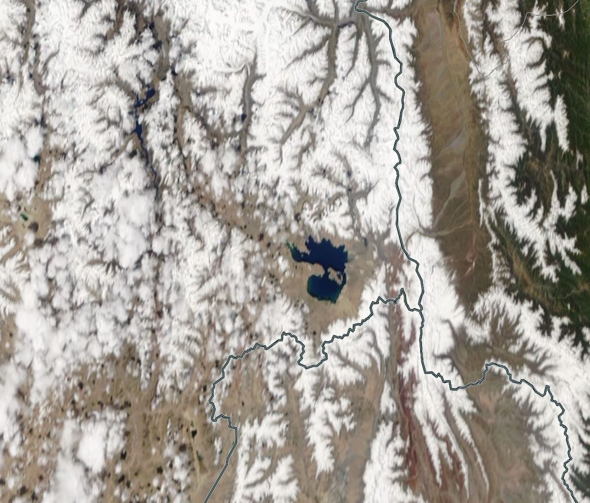
2018 Courtesy of Jeff Schmalz_NASA GSFC*
-
January/February: Fedchenko Glacier
The Fedchenko Glacier is situated in the northern central part of Tajikistan’s Gorno-Badakhshan Autonomous Region, within the Yazgulem Range of the Western Pamir Mountains. It is the largest glacier outside the polar regions. Officially renamed Vanch-Yakh by the Tajik government, the glacier extends for 77 km, descending from approximately 6,200 m asl to about 2,900 m asl. Its surface area is roughly 700 km², with a maximum ice thickness of around 1,000 m and an estimated total ice volume of 144 km³.
Although the glacier was long regarded as relatively stable compared with many other glaciers worldwide, long-term observations and recent datasets indicate a clear trend of retreat. Notably, pronounced ice‑thickness reduction was recorded between 2010 and 2021. One factor moderating the rate of mass loss is the extensive debris cover (moraines) on its surface, which provides thermal insulation and reduces melt rates.
In certain parts of the Pamir Mountains, increased snowfall over recent decades has temporarily contributed to glacier stability or even slight advances – a phenomenon often referred to as the “Pamir anomaly.” However, recent studies, including work by ISTA Austria and Swiss research teams, suggest that this phase of stability has ended. Since approximately 2018-2021, even the previously most stable glaciers in the region have exhibited substantial mass loss, indicating that a critical climatic tipping point has been surpassed under ongoing warming.

1982 expedition to Tartu Ülikool. Courtesy of Jaan Künnap 
2022 Courtesy of François Burgay